With the remission of COVID-19 this year, it is time to enjoy a trip to eastern Jeju, which offers a diverse range of sceneries such as oreums, the sea, and forests. Jongdal-ri offers oreums, Pyeongdae-ri offers forests, and Gyorae-ri offers Gotjawal. Meanwhile, Udo Island, which is reachable by ferry from Seongsan Port, is another island off the coast of Jeju Island.
Jeju’s most characteristic vista arguably consists of oreums. Home to a winding series of hills of varying heights, Jeju’s eastern plains are a paradise of oreums, where every hill that protrudes from the flat plains as one drives by is an oreum.
 |
||
| ▲ Darangshi Oreum Photo:Visitjeju.net | ||
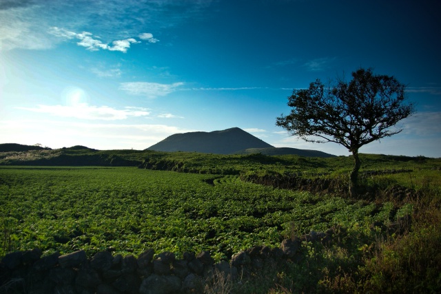
These oreums are particularly concentrated in the Jongdal-ri area, including Darangshi Oreum, which is among the most representative oreums of Jeju. The name “Darangshi” came from “dal,” the Korean word for “moon,” referring to the round moon-like shape of the crater at the peak of the hill. Otherwise known as “Wollangbong Peak,” it is known as the queen of oreums due to its elegant curves and aesthetically pleasing appearance.
Darangshi is among the taller oreums at an altitude of 382m above sea level, and has to be ascended on a zigzag trail across its steep, grassy side from the trail entrance to the peak. However, the ascent generally takes around 20 to 30 minutes at maximum, while the peak presents a panoramic view of the surroundings.
To the northwest, it is possible to see Bija Forest and Dot Oreum, and to the southeast, Yongnuni Oreum and the wind power turbines in the Jungsangan area. Even further out, Jeju’s northern and eastern coasts are faintly visible on the horizon. Underneath, there is a view of the enormous volcanic crater at the base. Contrary to the shape of the hill, the crater at Darangshi Oreum consists of an inverted cone that runs deep into the ground at a depth of 115m, like Baengnokdam, with a diameter of 30m at the bottom.
 |
||
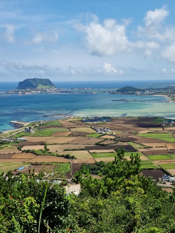
Meanwhile, located in Jongdal-ri, Gujwa-eup, Jimi Oreum presents a view of Jeju’s eastern seas. The name “Jimi” means “the tail of the land.” This oreum can be climbed in around 30 minutes up a steep hillside trail with the sea behind one’s back. From the top, one can see the juxtaposition between Seongsan Ilchulbong and Udo Island at a glance, while the passenger ferry to and from Udo Island and Dumunpo Port Village form a fine picture, to the backdrop of Jeju’s eastern oreums with Hallasan Mountain at the top.
 |
||
| ▲Udo Island | ||
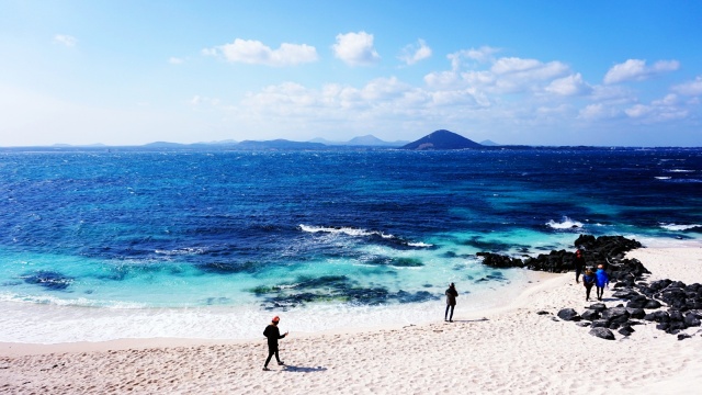
Udo Island’s name was inspired by its shape when seen from above, which was said to resemble that of a cow lying down. Its natural vista, consisting of gentle hills, coastal cliffs that retain the wonders of primal nature, and unique beaches formed by broken rhodoliths, combine with the dark-green fields cultivated by its residents, as well as the black stone walls and colorful roofs of houses, to create a scenery that is unlike the main island of Jeju.
A trip to Udo Island generally takes place in a clockwise direction from Chunjin Port, starting with Rhodolith Beach. As the name suggests, the beach was formed by rhodoliths that washed up upon the coast, and the combination of the emerald sea and ivory sand creates a beautiful and almost mythical scene. Rhodoliths are rock-like formations of calcium carbonate accumulated in the biological processes of red algae. As one of Udo Island’s Eight Beautiful Sites, Rhodolith Beach was once referred to as Udo Sanho Beach (Seobinbaeksa) or Sanhosa Beach, as it was believed that its sand consisted of corals (“sanho” means “coral” in Korean), until it was discovered that the substrate forming the white sand was not formed from corals.
A short drive in an electric vehicle brings visitors to a dazzling white lighthouse named “Mangru Lighthouse.” Beside the lighthouse, there is a bongsudae (fire beacon), which was used as a means of military communication in the Joseon dynasty to raise the alarm in emergencies. It is possible to reach the bongsudae up a basalt stairway. Next to the lighthouse, there is a recreation of tidal fishing traps (doksal). This traditional fishing method uses a type of stone-based trap to ensnare fish that reach the coast through the rising tide. This particular trap formation has been shaped like a heart, which has been favorably received by tourists.
Past Deuksaenggot Lighthouse, it is a short journey to Hagosudong Beach, which is renowned for leisurely summertime visits and its statues of haenyeo and mermaids. The beach is on a gentle gradient with mild waves, allowing children to play safely in the water. It also offers multiple attractions including kayaks. The beach has earned its nickname of “Saipan Beach” as it offers a range of exotic cafes around the beach.
The final destinations of the Udo Island trip are Udobong Peak and Geommeolle Beach. Udobong Peak is Udo Island’s sole mountain. Although the trail to the top is gentle, there is a sheer cliff into the sea on the other side. The name “Geommeolle” means “black sand,” as the cliff stands atop a sandy beach and consists of millions of layers of thin sediment layers. Its grand appearance resembles an immense roof or a whale swimming out to sea. Prior to visiting Geommeolle Beach, it is also recommended to visit the theme park designed after the works of world-renowned Austrian architect Friedensreich Hundertwasser.
Jeju Weekly editor@jejuweekly.net


